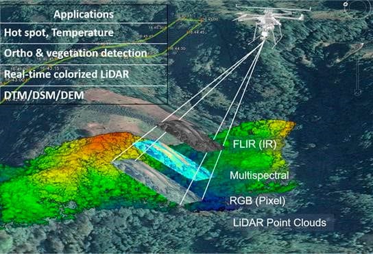
LEVERAGING ADVANCED REMOTE SENSING TECHNOLOGIES TO PROTECT OUR COMMUNITIES AND NATURAL RESOURCES Wildfires consume millions of acres of land every year, destroying homes, communities, and infrastructure across the United States and around the globe. Fire seasons are...
How one AEVEX employee’s work on real-time mapping would influence Google Earth When Don Burns was writing visualization software for NASA and supporting flight simulator development for McDonnell Douglas, Boeing, and the Army, he never thought that what started out...
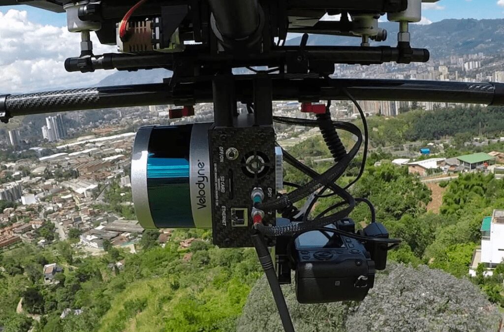
A Guide to Understanding LiDAR Sensors Function & Capability When we discuss Geo-MMS LiDAR sensor characteristics, there are many metrics and factors that go into understanding the oftentimes overwhelming information provided by LiDAR sensor manufacturers. This...
LiDAR Sensors for UAV / Drone Application When selecting the right LiDAR you must consider the various parameters that define the performance of the LiDAR sensor. These parameters are summarized in the table below. LiDAR Specifications Listed by Range If you are an...
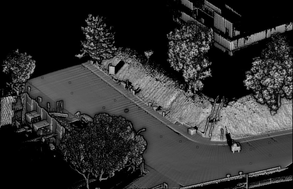
Road Surveying using Geodetics’ Geo-MMS LiDAR Suite of Products The purpose of this blog – the second in a two-part series – is to continue to explain the capabilities of Geo-MMS LiDAR payloads for road surveys and highway scanning. We will explore the wider workflows...