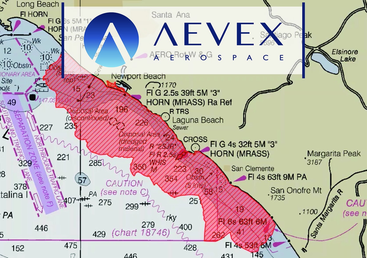
On Saturday, October 2, 2021 an oil pipeline off the coast of Huntington Beach, CA failed, causing 126,000 gallons of crude oil to spill into the waters just south of Los Angeles. As the race began to contain the 8,320-acre spill, it quickly became apparent that a key component of incident mitigation would be mapping and tracking the path of the spill.
As an industry leader in aerial real-time intelligence solutions, AEVEX Aerospace quickly established perimeter mapping within hours of the initial incident report. Our dedicated fixed-wing aircraft equipped with specialized sensors allowed us to quickly provide enhanced incident awareness and assessment (IAA) along with situational awareness software. This single platform solution effectively supports commanders and decision makers in critical response initiatives.
“Our goal is to establish and rapidly distribute data during the initial response, allowing for a fast and targeted response to the incident,” said Brian Raduenz, CEO of AEVEX Aerospace. “We were able to provide full motion video in real-time and generate an incident perimeter shortly after aircraft arrival at the site.”
Connected by pipeline to an offshore oil platform, the spill sent oil across an area spanning Newport Beach, Huntington Beach, and Talbert Marsh, a 25-acre wetland preserve that is home to 80 species of birds. Immediate damage control became critical as fish, birds, and beaches were threatened.
“I have serious concerns about the environmental impacts of the spill and applaud the workers who are doing their best to prevent the oil from hitting sensitive wetlands,” said Orange County Representative Michelle Steel.1
The Coast Guard received an initial report of the oil spill on Saturday morning and established a unified command along with Beta Offshore and California Department of Fish and Wildlife’s Office of Spill Prevention and Response. AEVEX helped to provide real-time data input to define the ever-changing situation and allow decision makers to flex their containment strategies. With USCG, NOAA, FEMA, Cal OES, and the Orange County Fire Authority tracking the spill, timely information was critical to managing multiple moving parts. AEVEX products were pulled and distributed throughout the various agencies and individuals involved.
“We are not only dedicated to serving our customers and partners, but also the communities in which we live and work,” said Raduenz. “Tracking this spill and providing evolving data is a priority for us, and we will continue to utilize our technology and expertise to help mitigate this to benefit the southern California coast and the environment that makes it so unique.”
ABOUT AEVEX AEROSPACE
AEVEX Aerospace, headquartered in Solana Beach, California, supports defense and commercial clients around the world by providing full-spectrum aviation, remote sensing, and analysis solutions. The company’s capabilities include custom design and engineering, sensor integration and sustainment, aircraft modification, test and certification, mission operations services, advanced intelligence data processing, exploitation, and dissemination solutions, and tailored hardware and software mission-system tools, including assured precision navigation systems. AEVEX uses agile and customized approaches to rapidly define, develop, and deliver specialized solutions for airborne special mission needs for the US Government, partner nations, and commercial businesses. AEVEX has major offices in California, Florida, Ohio, and Virginia. www.aevex.com.


