


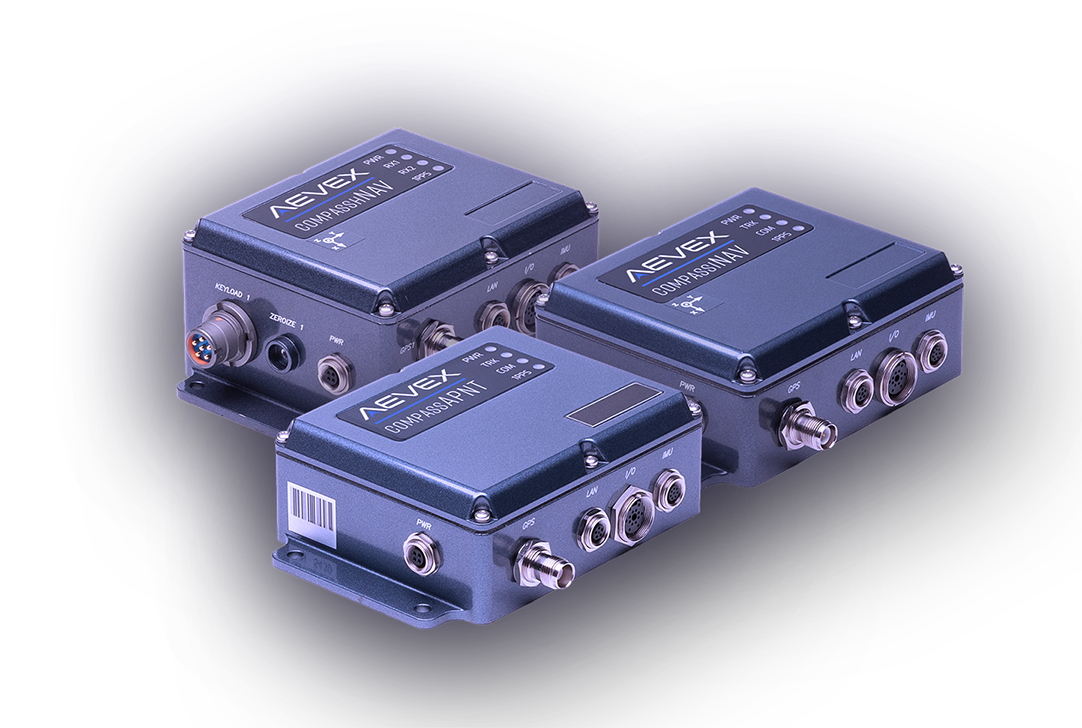
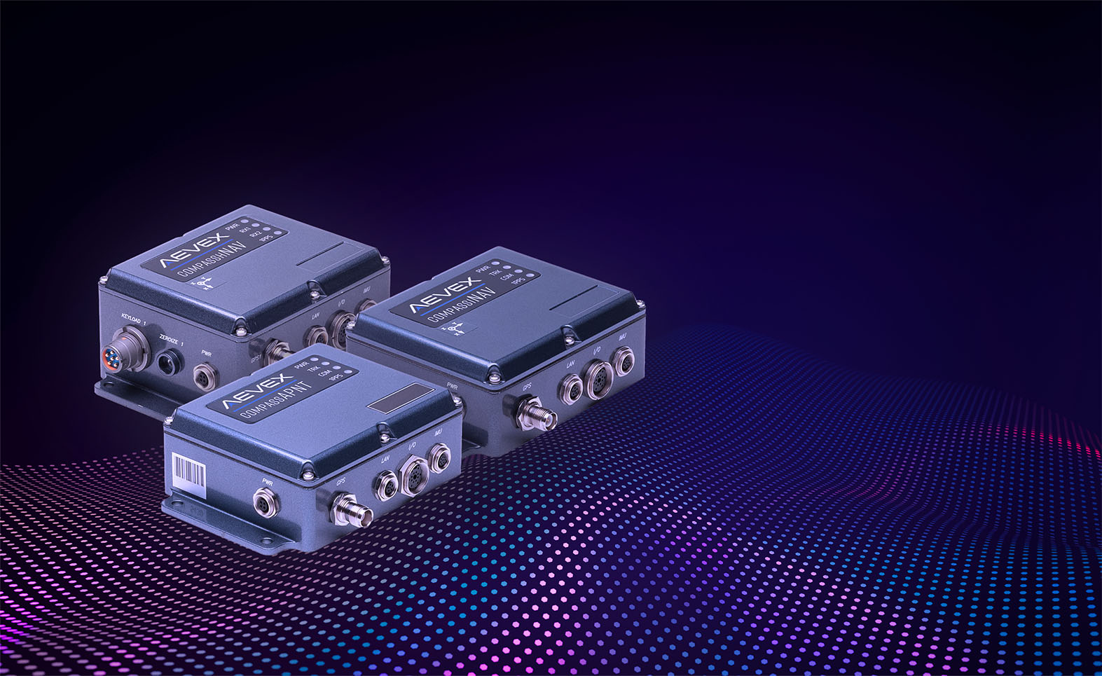
CompassPNT
AEVEX CompassPNT delivers advanced assured position, navigation, and timing solutions that ensure precision, resilience, and autonomy in GPS-denied environments—engineered to need and built for mission success.
Designed to Optimize Performance in Degraded/Denied Environments
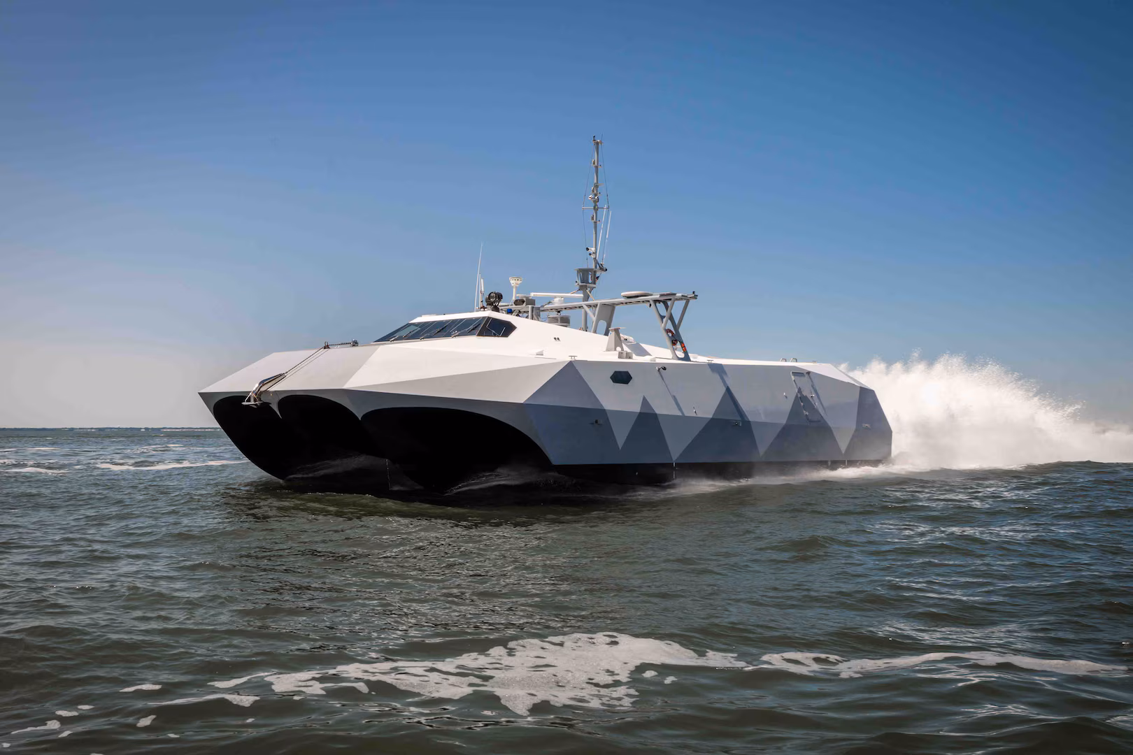
The AEVEX CompassPNT family of systems delivers advanced Assured Positioning, Navigation, and Timing (A-PNT) solutions that provide precise, reliable performance across air, land, and sea domains. Our expertise in algorithms, Kalman filtering, and multi-sensor fusion enables accurate, resilient navigation for mission-critical operations. With capabilities including relative navigation, integrated timing, and high-speed positioning, CompassPNT systems support both manned and autonomous platforms—empowering confidence and continuity in the most demanding environments.
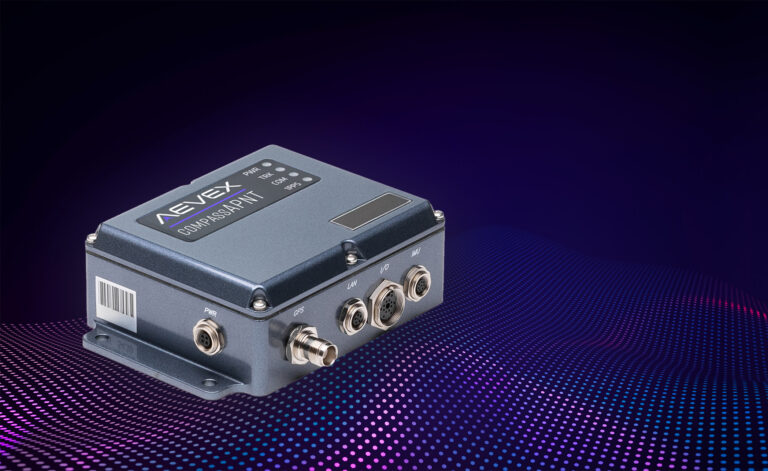
CompassAPNT
CompassAPNT
View Spec Sheet
CompassAPNT delivers assured position, navigation, and timing (PNT) when GPS is compromised or degraded. Integrating a high-performance GPS master clock with an advanced inertial navigation system, CompassAPNT provides continuous, precise data for dynamic platforms in all environments. By combining positioning and timing into a single, compact unit, it reduces size, weight, and power while maintaining the accuracy and reliability needed for mission success.
- Size/ Weight/ Power:
- 33.8 in3 (4.73 x 3.95 x 1.81) / 20 oz., 10 – 30 VDC @ 2 Amps min. (not including external IMU)
- Temperature Range:
- Specified: -20°C to +65°C | Operating: -40°C to +70°C
- Interfaces:
- External power connector, TNC GPS antenna connector, 1 Ethernet data port, 3 RS-232 serial ports, Timing I/O, 10 MHz clock, 4 status LEDs
- Real-Time Data Output:
- Navigation solutions at 100 Hz. available via Ethernet, RS-232, Solution Latency – 16 microseconds 1δ
- Data Recording/Logging Navigation solutions:
- raw GPS & IMU data (for post-processing)
- Built-in support for many commonly used IMU’s:
- Honeywell HG19001
- HG1930, HG17001
- HG99001
- Northrup Grumman LN2001
- KVH 1725, 1750, 1775
- Other IMU’s available upon request
- Web User Interface:
- status, configuration, log, SW update
- DCLS:
- x3 configurable digital outputs (1PPS, IRIG B002), 3.3V, 50W
- RS232:
- x1 NMEA ToD message (GPZDA, GPRMC)
- Frequency:
- 10 MHz, sine, 0 dBm in 50W
- Network:
- PTP Grandmaster (IEEE 1588 v2), NTP server (v3, v4)
1 ITAR Restrictions Apply
*Please note that the CompassAPNT SAASM specs may differ
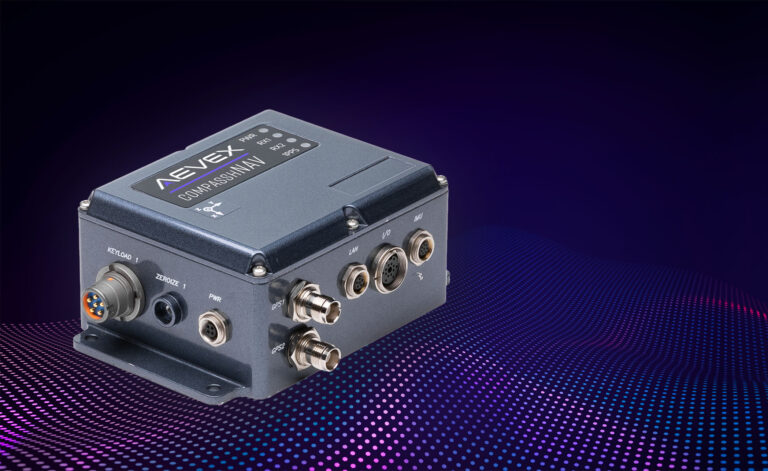
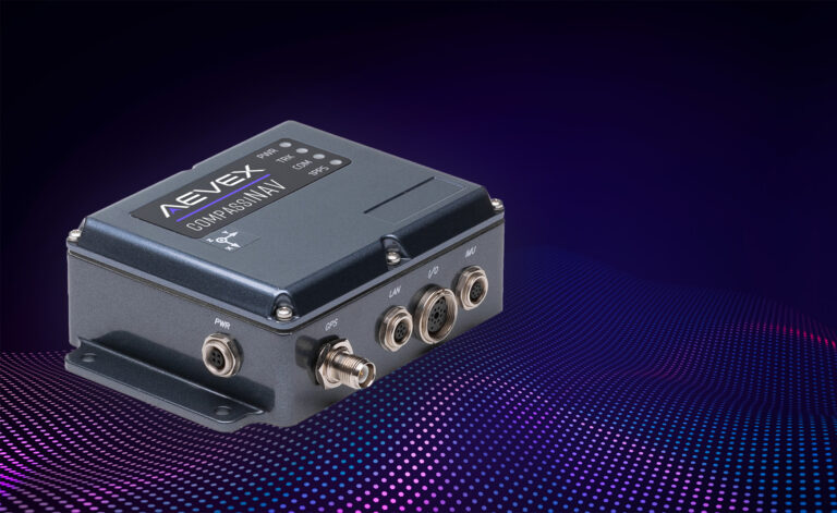
CompassHNAV
CompassHNAV
View Spec Sheet
CompassHNAV is a rugged, fully integrated hybrid navigation system that fuses dual-GPS inputs with advanced inertial sensors to deliver precise position and attitude data in any environment. Whether the platform is stationary or in motion, CompassHNAV ensures continuous, reliable navigation performance. Available in configurations for both commercial and military applications, including SAASM-enabled options, it provides the accuracy and resilience needed for assured navigation across any mission.
- External IMU: 15 to 20 W typical (external IMU powered by main unit)
- SAASM:
- Internal IMU: 10 W typical
- External IMU: 10 to 13 W typical (external IMU powered by main unit)
- Data Recording / Logging:
- Navigation solutions (position, velocity, acceleration, attitude, angular rate, …)
- Raw GPS and IMU data (for post processing with RTD-Post)
- Full diagnostics
- External IMU Support:
- Fiber Optic Gyro is standard in Advanced configurations. Built-in support for:
- Emcore TAC-450
- Inertial-Lab FI200C
- Honeywell HG1900
- Honeywell HG1700
- Honeywell HG9900
- Litton LN200
- Other IMU’s on request
- Safety and Diagnostics:
- Internal safety and monitoring systems
- Internal BIT with operator notification
- Environmental:
- Civilian Operating Temperature: -40°C to +65°C (-40°F to 150°F)
- SAASM Operating Temperature: -40°C to +70°C (-40°F to 158°F)
- Storage: -55°C to +85°C (-67°F to +185°F)
- Humidity: 95% RH, non-Condensing
- Vibrations and Shock: MIL-STD 810G, 514.5 and 516.5
- EMC/EMI: MIL-STD 461
- Monitoring:
- VYO Real-Time Navigation Visualization Tool as convenient interface to visualize time, position, attitude and related information (TSPI) streamed data
- CompasshNAV Enclosure:
- Size: 120 x 100 x 55 mm (4.7” x3.9” x 2.2”)
- Weight: 0.75 kg (1.7 lbs.)
- Mounting: On a plate, 4 through holes
- Interfaces:
- External power connector
- Dual TNC GPS antenna connector
- 1 Ethernet data port
- 3 RS232 serial ports
- 1 PPS output
- IMU connector for external IMU
- 4 status LEDs
- SAASM Configurations:
- Keyload connectors (DS-101)
- Zeroize buttons
- Fiber Optic Gyro is standard in Advanced configurations. Built-in support for:
CompassINAV
CompassINAV
View Spec Sheet
CompassINAV is a fully integrated GPS-aided inertial navigation system supporting a wide range of IMU grades and providing a high performance, trusted positioning, and navigation capability.
- Size / Weight / Power:
- 8 in³ (4.73×3.95×1.81) / 20 oz. / 10 – 30 VDC @ 2 Amps min. (not including external IMU’s)
- Temperature Range:
- Specified: -20°C to +65°C
- Operating: -40°C to +70°C
- Real-Time Data Output:
- Navigation solutions at 125/200 Hz (MEMS), 100-400 Hz. (FOG, RLG). available via Ethernet, RS-232
- Data Recording/Logging:
- Navigation solutions, raw GPS & IMU data
- VYO Real-Time Navigation Visualization Tool as convenient interface to visualize time, position, attitude and related information (TSPI) streamed data
- External IMU Support:
- Fiber Optic Gyro is standard in Advanced configurations. Built-in support for:
- Honeywell HG1900, HG1700, HG9900
- Litton LN200, Inertial Lab Fl200C
- Emcore TAC -450
- Other IMU’s available upon request
- Fiber Optic Gyro is standard in Advanced configurations. Built-in support for:
Let’s Move the Mission Forward.
Reach out to AEVEX to learn how CompassPNT delivers resilient positioning, navigation, and timing across air, land, and maritime domains, ensuring precision and reliability in GPS-degraded or denied environments.